
Tekmap Consulting provides a wide variety of marine geomatics services that range from:
- Sonar data processing and mapping.
- Data fusion and 3-D visualization.
- Custom software development for data logging, processing, and mapping.
- Ocean sensor data mapping and 3-D visualization.
- Shallow water surveying.

Our marine geomatics services include:
| Marine Geomatics Service | Description |
|---|---|
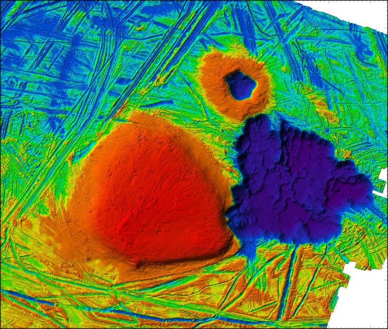
| Multibeam Data Processing | Processing, mapping, and 3-D visualization of multibeam sonar data. |
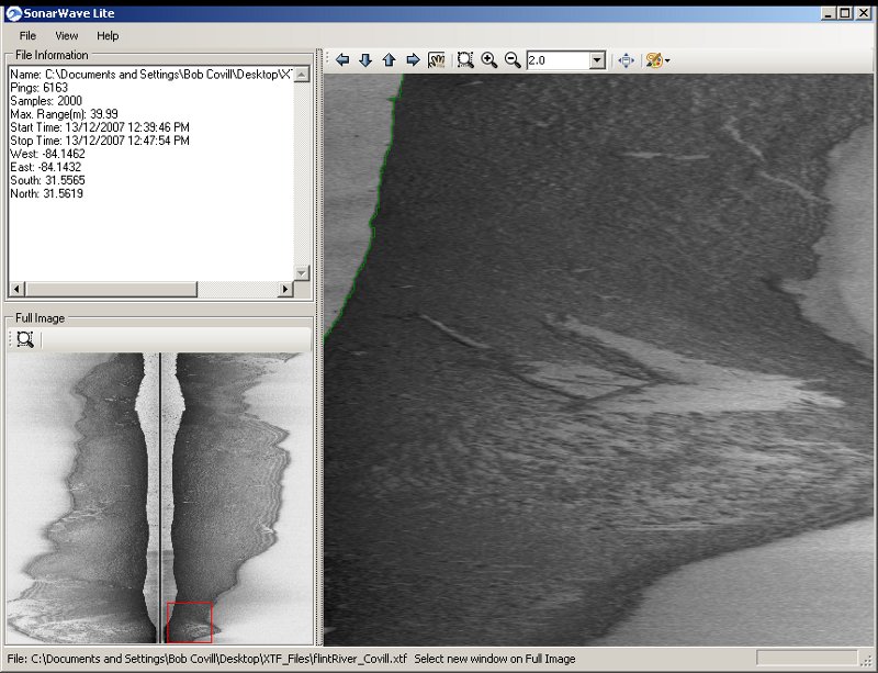
| Sidescan Data Processing | Processing and mapping sidescan sonar data. |
| Tidal Data Processing | Visualizing and mapping tidal model data. |
| Shallow Water Mapping | Surveying shallow water coastal environments using a customized Humminbird fishfinder. |
Tekmap Consulting provides nearly 20 years of experience in the Marine Geomatics field. Over this time, we worked on a number of projects in a variety of conditions. Our projects range from a simple survey of an abandoned open-pit mine site to on-site assistance for the search for Swissair Flight 111 in St. Margaret's Bay, Nova Scotia.
For more information on a specific service or to obtain an estimate, please contact us.