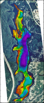
The Sync Humminbird Logging System (SHLS) is a compact, easy to use, shallow water mapping system. The SHLS is a portable, PC based, logging system that collects and records time-stamped, georeferenced, multibeam data. The system uses a customized Humminbird Wide 3D Paramount fishfinder.
The Humminbird sonar uses 6 separate beams for mapping the bottom. The 6 beams provide 53 degrees of continuous coverage up to 70 metres deep. The acrosstrack coverage is approximately 1 times water depth. For example, in 10 metres of water, the swath width is 10 metres with a resolution of 1.6 metres.
SHLS Application
The SHLS operates in water depths ranging from 2 to 70 metres and works with most shallow water vessels. Possible applications for the SHLS include:
- Aquaculture site evaluations.
- River and lake surveys.
- Engineering projects such as shipping channel surveys, dredge site evaluations, and tailings ponds.
- Coastal research projects.
Technical Specifications
| Humminbird Wide 3D Paramount Specifications | |
|---|---|
| Frequency | 455 kHz |
| Maximum ping rate | ~4 Hz |
| Number of beams per ping | 6 |
| Transducer | (standard) SHS-7W with 6 m cable |
| Transducer area of coverage |
53° Continuous Side-to-Side Coverage @ -10db |
| Power requirement | 12 VDC |
| Power output |
(455 kHz) 600 Watts (RMS) 4800 Watts (Peak to Peak) |
| Maximum water depth | 70 m |
| Swath width | 1 x water depth |
Links
- SHLS Fly-Through in the Movie Gallery
-
SHLS Product Specifications brochure
(PDF file size 731 Kb) - Humminbird Web site—Humminbird is a registered trademark of Techsonic Industries, Inc.
For more information about the Sync Humminbird Logging System, please contact rcurrie@tekmap.ns.ca.


