
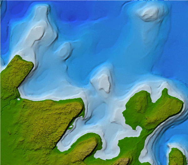
 Tekmap Consulting uses custom algorithms to create interpolated digital elevation models (DEMs) by combining data from a variety of sources. Data types include:
- Contours
- Point elevations
- Bathymetric soundings
- LiDAR
- Multibeam bathymetry
The data density determines the optimal resolution for the DEM. We use artificial lighting options to highlight geographic features in DEMs.
After creating a DEM, we can use custom color tables to simulate changes in the environment.
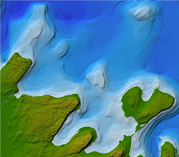
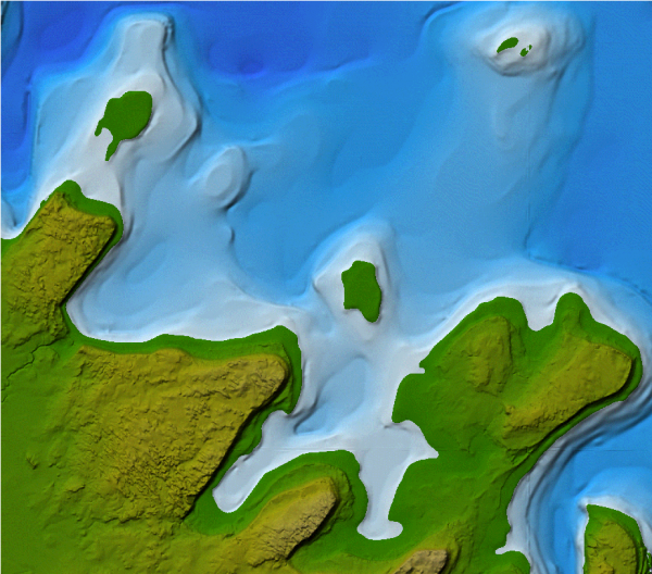
For example, we can raise water levels to show possible flood conditions, or we can lower water levels to represent historic sea-level changes.